Directions BoggyCreek East Lake
Route Planners & Maps to Orlando's #1 Airboat Rides!
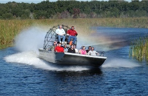 Directions Boggycreek East Lake...Are you travelling by car? If so, you'll most likely be using the 192, Osceola Parkway and Poinciana Blvd. All these roads will take you
to the airboats at Lake Toha (East Lake Kissimmee). Click here for Southport park location. Directions Boggycreek East Lake...Are you travelling by car? If so, you'll most likely be using the 192, Osceola Parkway and Poinciana Blvd. All these roads will take you
to the airboats at Lake Toha (East Lake Kissimmee). Click here for Southport park location.
Depending on the time of year (High season etc) and what part of Orlando you're coming from, this should take you around 15mins - 1hr.
If you already know where your staying in the Orlando/Kissimmee area, please use this
useful Google road map planners below for directions Boggycreek east lake.
Address & Sat Nav Details:
Boggy Creek Airboat Rides
3702 Big Bass Road,
Kissimmee,
FL 34744
Tel No: 407-344-9550
GPS Info. (Latitude, Longitude):
28.345888, - 81.331190
28°20'45.19"N, 81°19'52.28"W
Route Planners & Maps:
Orlando area (North)
Highway 27 area (South West)
Buenaventura Lakes area (South East)
Crescent Lakes area (South)
Kissimmee area (South East)
Please take a look at our travel map page for
futher directions around the area. Or browse our Orlando
travel books page for some great guides & travel information around the Central
Florida area.
Just like your paperboy
We will keep updating this page via our RSS feed. regarding new
additions, changes etc, so click onto the RSS feed
above and follow the instructions to keep you on top off what's happening in and around Orlando, including updates for directions Boggycreek east lake.
|